Direct Overview: Kanyakumari Lighthouse Viewpoint
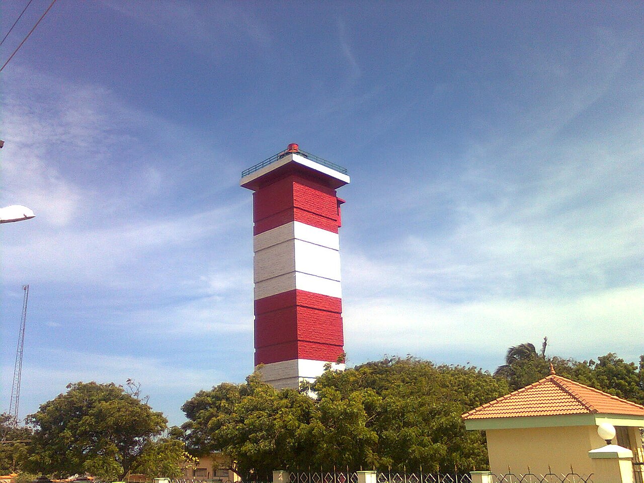
What is the Kanyakumari Lighthouse? Standing proudly near the shore at Cape Comorin, the Kanyakumari Lighthouse is a 47-meter-tall (154 feet) navigational tower operated by the Directorate General of Lighthouses and Lightships. Equipped with a modern passenger elevator taking visitors to an open-air observation gallery, it delivers the single best 360-degree aerial vantage point in southern India, overlooking the confluence of the Indian Ocean, Arabian Sea, and Bay of Bengal.
1. Technical & Navigational Heritage
For centuries, the rocky waters off Cape Comorin were notorious among global mariners. Before the modern lighthouse was constructed, a simple oil beacon operated atop a wooden mast near the shore.
The current modern lighthouse tower was commissioned in 1971:
- Tower Height: 47 meters (154 feet) cylindrical reinforced concrete tower painted with bold horizontal bands of red and white.
- Focal Height: 54 meters above mean sea level.
- Optical Power: A 2.25 million candela optical beacon with a high-intensity metal halide lamp inside a rotating glass prism lens, casting a beam visible for 24 nautical miles (over 44 km) into the Indian Ocean.
- Modern Technology: Fitted with automated DGPS (Differential Global Positioning System) transmitters and radar responder beacons (*RACON*) assisting modern global container ships in international sea lanes.
2. The 360-Degree Aerial Observation Gallery
Stepping out onto the circular open-air viewing gallery at the top is an unforgettable sensory experience. The strong ocean breeze fills the air as you take in an unmatched geographic perspective:
- Looking South-East: The sacred twin islands of the Vivekananda Rock Memorial and the 133-foot stone Thiruvalluvar Statue, with the new Curved Glass Sea Bridge glowing transparent over the emerald water.
- Looking South: The vast, endless horizon of the open Indian Ocean stretching all the way to Antarctica.
- Looking West: The golden sandy sweep of Sunset Point, the coastal fishing harbor, and the setting sun sinking into the Arabian Sea.
- Looking North: The bustling streets of Kanyakumari town, the temple gopurams, the pink dome of the Gandhi Mandapam, and the towering mountain ridges of the Western Ghats meeting the ocean.
3. Visitor Timings, Ticket Prices & Elevator Access
- Visiting Hours: 3:00 PM to 6:30 PM daily (ticket counter closes at 6:00 PM).
- Entry Ticket: ₹20 per adult; ₹10 per child (under 12 years).
- Elevator Fee: Included in the ticket (takes you directly to the 10th floor).
- Camera Permit: ₹25 for digital still cameras; ₹50 for video cameras.
- Museum & Heritage Gallery: The ground floor houses an educational museum displaying vintage Fresnel glass prisms, antique brass oil lamps, and models of historic Indian lighthouses.
4. Photography Advice for the Lighthouse Gallery
- Best Timing for Photography: Arrive at 4:30 PM. The late afternoon sunlight illuminates the eastern face of the Thiruvalluvar Statue and Vivekananda Rock, while minimizing harsh haze over the ocean.
- Lens Recommendation: A wide-angle lens (16–35mm) captures the full 360° curvature of the three seas, while a telephoto zoom (70–200mm) yields stunning close-up portraits of the glass sea bridge and ocean ferries navigating the waves.
5. How to Reach the Lighthouse
The lighthouse is situated at the southern end of Beach Road in Kanyakumari, an easy 5-minute walk from the Gandhi Memorial and Bhagavathi Amman Temple.
6. Comparison: Kanyakumari Lighthouse vs. Muttom Lighthouse
| Feature | Kanyakumari Lighthouse | Muttom Lighthouse |
|---|---|---|
| Location | Cape Comorin (Town Promenade) | Muttom Village (16 km west of Nagercoil) |
| Tower Height | 47 meters (Modern 1971 Tower) | 22 meters (Colonial 1875 Tower) |
| Elevator Access | Yes (Modern high-speed passenger lift) | No (Internal spiral staircase) |
| Primary View | 360° Tri-Sea Confluence & Glass Bridge | Rugged granite sea cliffs & Arabian Sea sunset |
| Guide Link | Kanyakumari Lighthouse | Muttom Lighthouse |
7. Full Evening Walking Tour from the Lighthouse
- 03:30 PM: Take the elevator up the Kanyakumari Lighthouse for 360° aerial photography.
- 04:45 PM: Walk 300 meters north along Beach Road to visit the pink Gandhi Memorial Mandapam and Kamarajar Mandapam.
- 05:30 PM: Walk down to the rocky shoreline at Sunset Point to watch the evening twilight over the Arabian Sea.
- 06:45 PM: Explore the vibrant seaside market stalls selling seashells, palm-leaf crafts, and local South Indian street snacks.
8. Navigational History & Maritime Significance
Cape Comorin has occupied a pivotal position in global oceanic navigation for over two thousand years. Ancient Greek and Roman sailing manuals, including the 1st-century CE Periplus of the Erythraean Sea and Ptolemy’s Geography, specifically reference the prominent headland of Komaria (Kanyakumari) as the primary navigational waypoint for merchant galleys crossing the Indian Ocean between the Red Sea, the Malabar spice ports, and the Coromandel coast.
Today, the modern lighthouse continues this ancient legacy, utilizing state-of-the-art satellite navigational aids to guide thousands of international oil tankers, cargo ships, and container vessels passing along the busy east-west shipping lane just 10 nautical miles south of the Cape.
9. Ideal Time for Golden Hour Photography
For the best lighting, enter the lighthouse between 4:00 PM and 5:00 PM. The golden sunlight illuminates the Vivekananda Rock and Thiruvalluvar Statue, casting long shadows across the calm winter sea and creating postcard-perfect aerial photographs.
Post-Viewpoint Evening Snacks in Vadasery
After taking in the 360-degree aerial views from the Lighthouse, drive into Nagercoil for your evening tiffin! Visit RajaGopal Sweet Stall on Asambu Road in Vadasery for hot onion cashew pakoda, crispy banana chips, and Tirunelveli-style wheat halwa.
Call RajaGopal Sweet Stall Order on WhatsApp