Direct Overview: Capturing Land's End
Kanyakumari offers one of the world's most dynamic natural lighting environments: standing at India's southern tip, you can capture the golden orb of the sun rising out of the Bay of Bengal at dawn and sinking into the Arabian Sea at dusk from the same coastal stretch. Beyond the postcard monuments, the district holds dramatic geological cliffs, infinite wind turbine corridors, and elevated canopy aqueducts that offer rich creative opportunities.
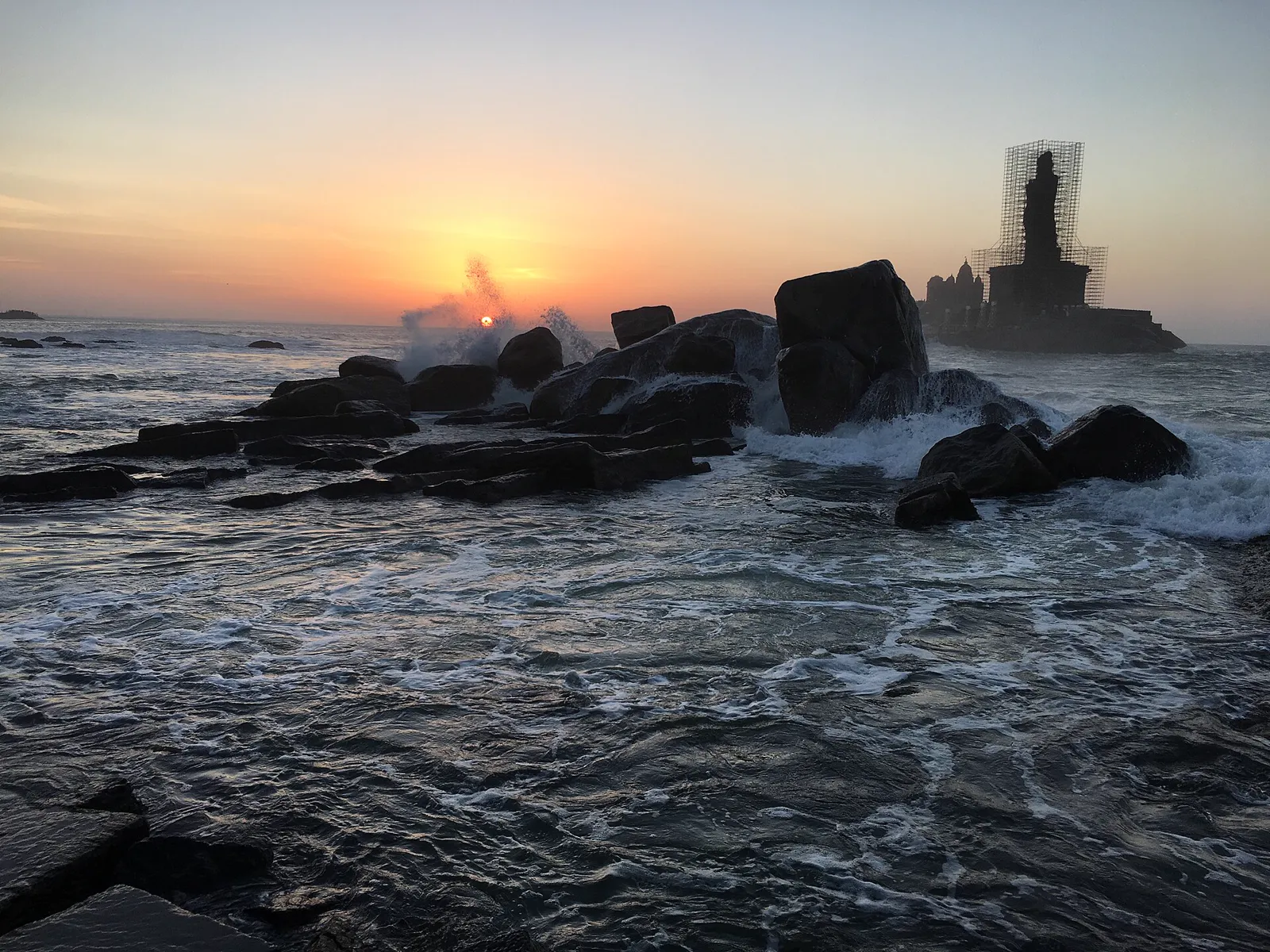
1. Triveni Sangam Shoreline (Sunrise & Blue Hour)
GPS Focus: Eastern promenade directly beside Kanyakumari Bhagavathy Amman Temple
This is the iconic Land's End frame. Between October and March, the morning sun rises directly between the twin rock islands of Vivekananda Rock Memorial and the 133-foot Thiruvalluvar Statue.
- Optimal Timing: Arrive by 5:30 AM for the deep purple-orange pre-dawn gradient (Blue Hour). The sun crests the ocean horizon between 6:00 AM and 6:15 AM.
- Gear Advice: Use a sturdy tripod with a 70-200mm telephoto lens to compress the monuments against the golden sun. A 3-stop ND filter allows smooth, silky water long exposures over the coastal rocks.
2. Muttom Beach Cliff Tops (Golden Hour & Wave Crashes)
Location: 32 km west of Kanyakumari near Colachel
Muttom is dramatically different from typical sandy beaches. Famous for its towering red-clay cliffs that plummet directly into the Arabian Sea, it features a 100-year-old colonial lighthouse and rugged granite reefs where breakers crash in explosive white sea spray.
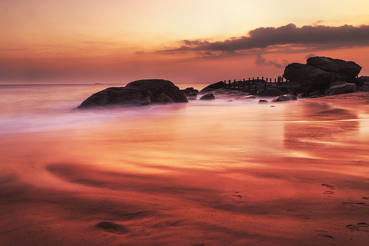
- Creative Angle: Walk the cliff path 200 meters south of the lighthouse. Shoot downward with a 24-70mm lens to capture the contrasting red soil, turquoise breakers, and traditional fishing boats.
- Best Time: 5:00 PM to 6:15 PM for warm, raking sidelight across the cliff faces.
3. The Curved Glass Sea Bridge (Mid-Morning Contrasts)
Location: Kanyakumari Pier promenade (opened late 2024)
Extending out over the rocky surf on reinforced cantilevered steel piers, the Curved Glass Sea Bridge provides an ultra-modern vantage point. When sunlight is high (around 9:30 AM to 11:00 AM), clear light penetrates through the multi-layer laminated transparent glass floor, revealing churning ocean foam, granite bedrock, and marine life directly underneath your feet.
- Shooting Tip: Use a Circular Polarizer (CPL) filter on an ultra-wide (16-35mm) lens to cut surface reflection from the glass, revealing the emerald water below.
4. Aralvaimozhi Pass Wind Farm Corridor (Monsoon & Cloudscapes)
Location: NH 44 / Muppandal pass, 18 km north of Kanyakumari
One of the largest onshore wind power installations in Asia, the Muppandal and Aralvaimozhi wind corridor sits within an immense natural gap in the Western Ghats. High-velocity winds rush through this valley, turning thousands of towering white wind turbines in continuous motion.
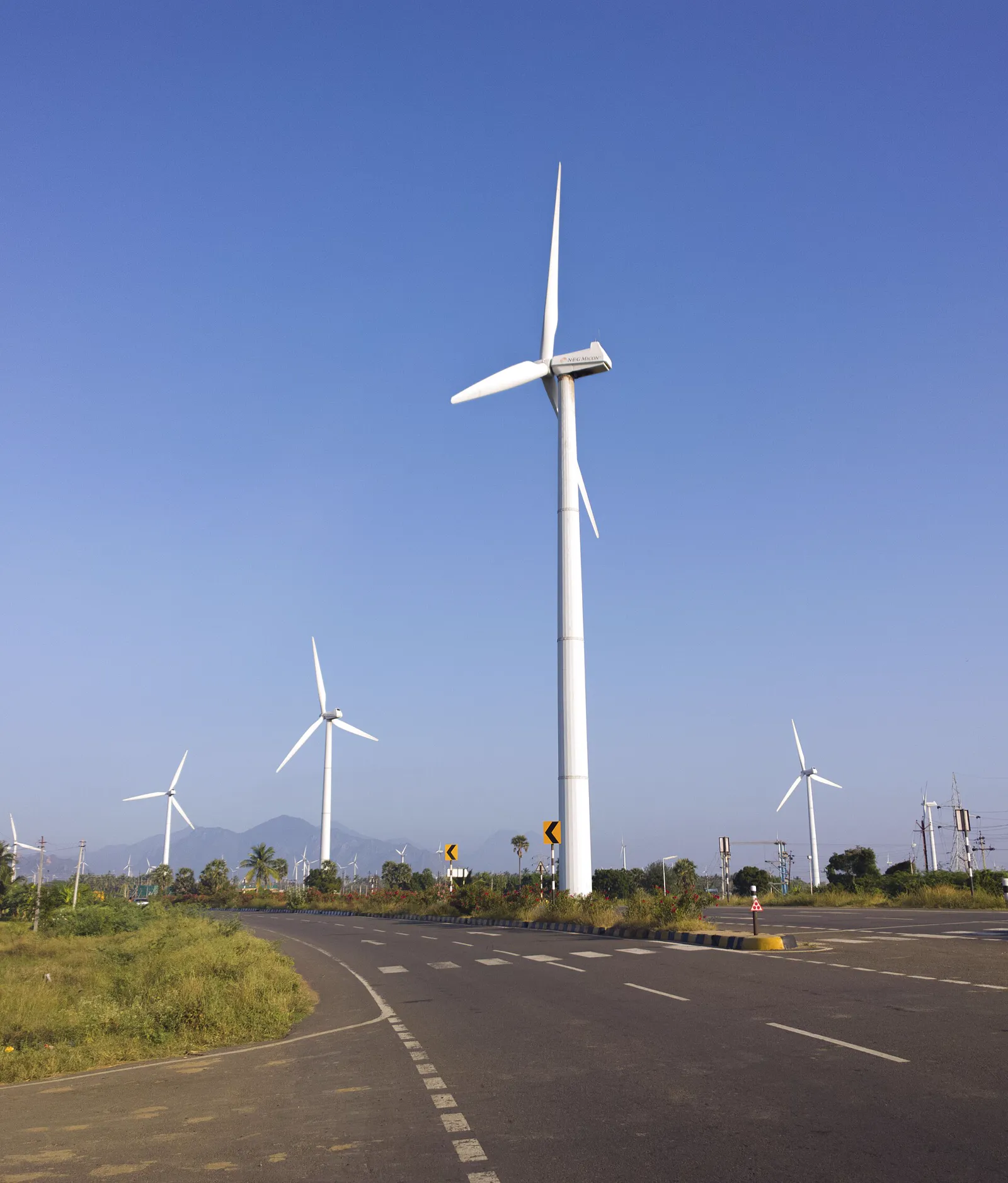
- Creative Technique: Use a long telephoto lens (200mm+) to align multiple ranks of turbines. When dark monsoon rain clouds roll over the jagged peaks of Mahendragiri, the stark white towers provide intense graphic contrast.
5. Thiruvalluvar Statue from the Coastal Rocks
Location: Rocky promontory near the Government Boat Jetty
Standing 133 feet tall (symbolizing the 133 chapters of the ancient Tamil moral treatise Tirukkural), the granite statue of Thiruvalluvar is a towering masterwork of stone engineering.
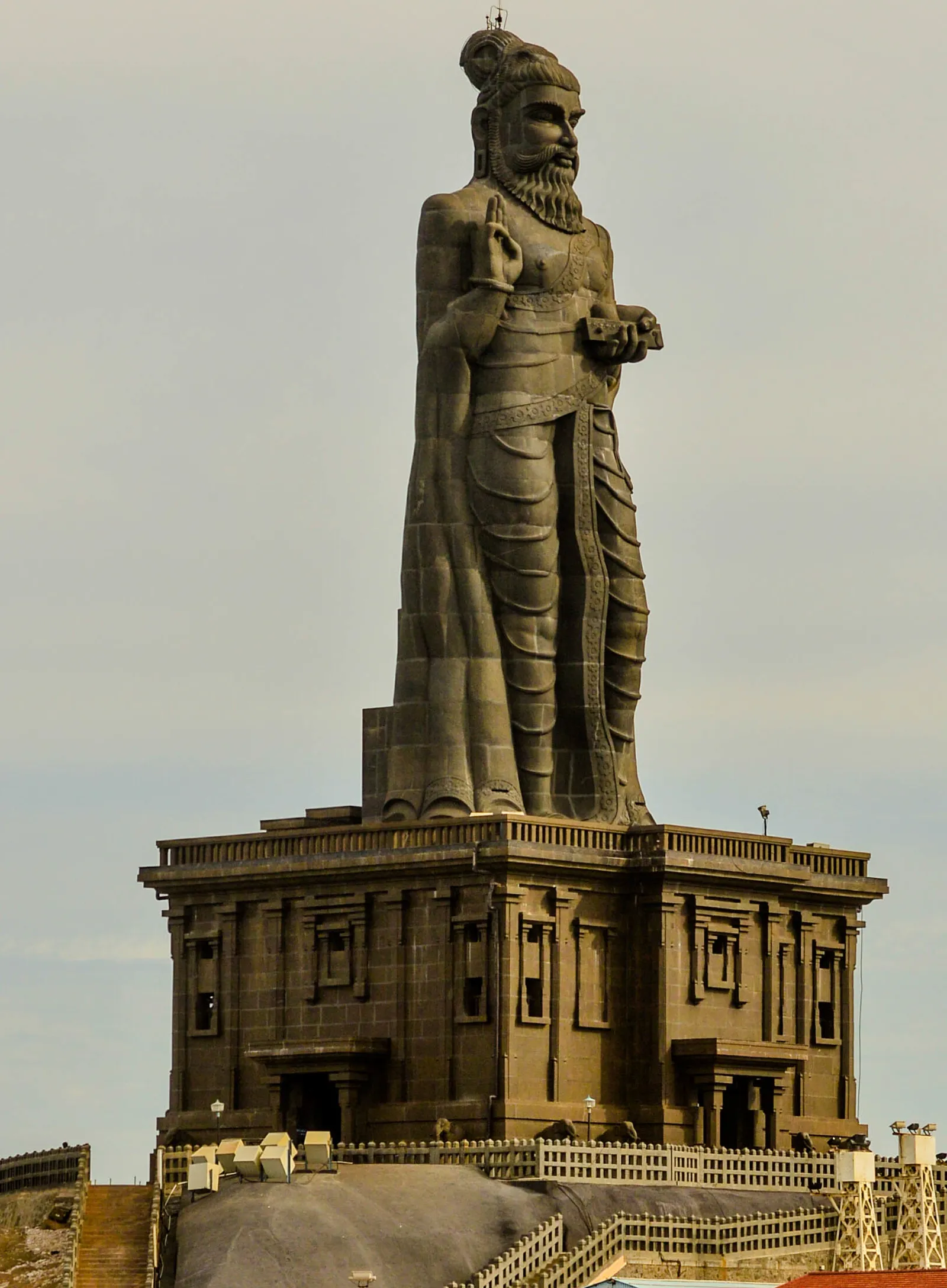
- Framing Idea: Frame the sage's three upright fingers (signifying Aram, Porul, and Inbam) silhouetted against dramatic sunset skies or low-tide breaking waves.
6. Vattakottai Fort (Granite Ramparts & Ocean Panorama)
Location: 6 km north of Kanyakumari on the coastal highway
The 18th-century granite coastal fort offers a dual landscape: to the east, endless blue horizons of the Bay of Bengal; to the west, dense palm plantations backed by mountain ridges. Shoot from the eastern cannon parapets during early morning or late afternoon for clean, architectural lines.
7. Mathur Aqueduct Skywalk (Canopy Symmetry)
Location: 30 km from Nagercoil near Thiruvattar
Standing 115 feet above the Pahrali River gorge, looking straight down the 1,240-foot length of this elevated concrete flume offers dramatic one-point perspective framing. Telephoto portraits of subjects walking the center aisle surrounded by tropical palm canopies produce striking images.
8. Sanguthurai Beach (The White Conch & Dune Lines)
Location: 12 km southwest of Nagercoil
Featuring pristine white sands and a monumental sculpture of a conch shell (*Shankha*), Sanguthurai is famous for minimalist seascape compositions. Shoot long exposures at twilight as the monument glows against deep indigo skies.
9. Sunset View Point (Kovalam Road)
Location: Western shoreline, 2 km west of Kanyakumari town
This is the prime location to witness the sun dip cleanly into the Arabian Sea. During full moon days (*Chitra Pournami*), photographers can capture the sun setting on the western horizon while the full moon simultaneously rises out of the eastern sea.
Photographer's Dedicated Standby Cab
Chasing golden hour lighting requires patience and flexible transit. Avoid lugging heavy camera backpacks, tripods, and drone cases on crowded public buses. Our private driver network provides early 5:00 AM sunrise pickups and stays on standby until the last blue hour glow fades.
 Light, non-greasy shoot energy
Drone Photography Regulations in Kanyakumari
| Zone / Location | Drone Flight Status | Permit Requirements | Notes |
|---|---|---|---|
| Vivekananda Rock & Jetty | Red Zone (Strictly Prohibited) | Defense & Coast Guard clearance only | Active naval surveillance zone |
| Muttom Beach & Cliffs | Green Zone (Permitted below 400ft) | Standard DGCA DigitalSky registration | Keep safe distance from lighthouse radar |
| Aralvaimozhi Wind Farms | Green Zone (Permitted) | Standard micro/small drone rules | Watch for strong rotor turbulence and wires |
| Lemur Beach (Azhikkal) | Green Zone (Permitted) | No special defense clearance | Great for pre-wedding aerial shots |